
Earth True Colour
 Image
ImageRes:
Image:
Low Res Med Res Hi Res 4KSource: NASA Earth Observations
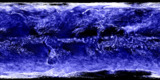
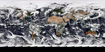
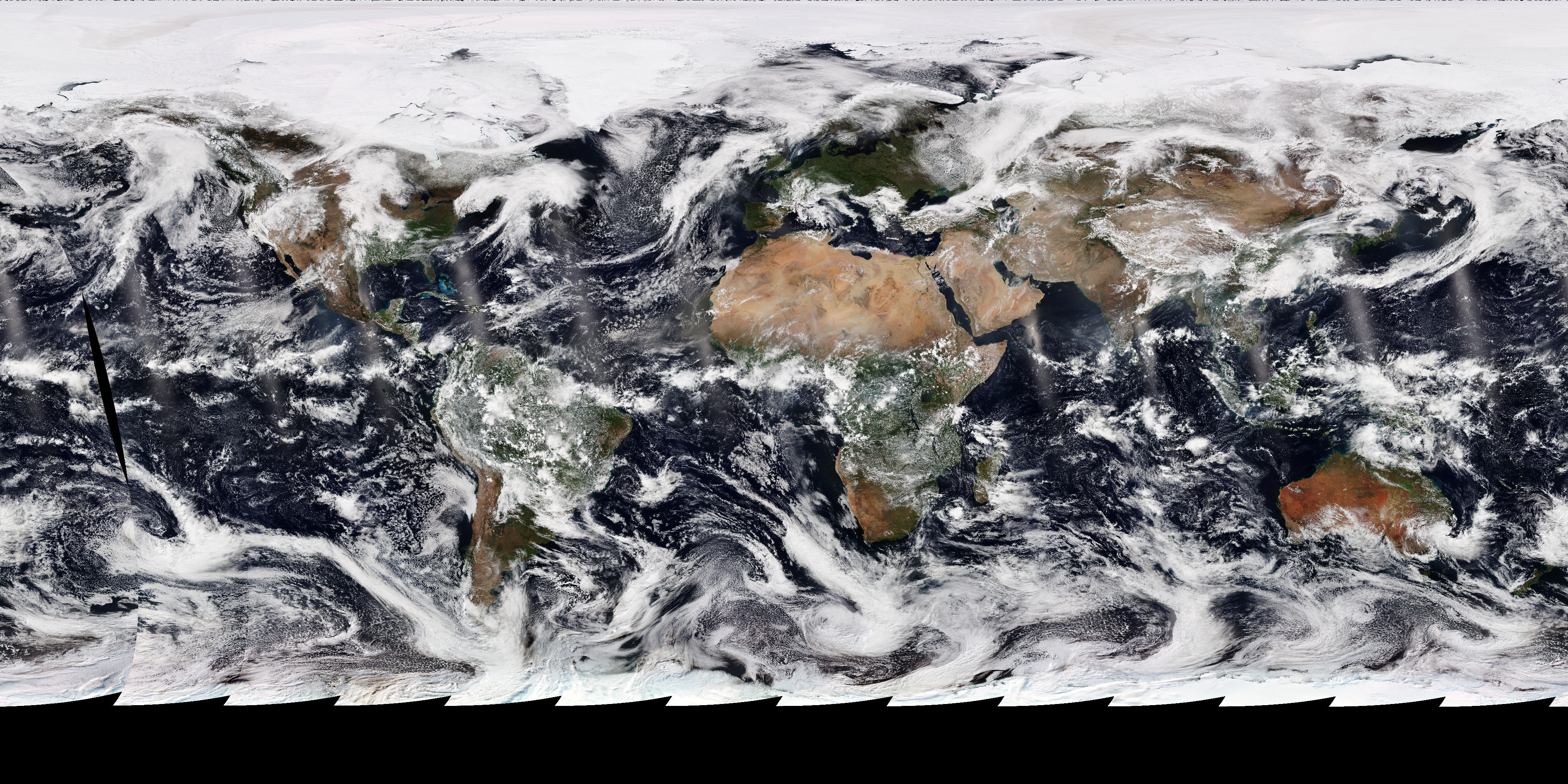
This is a real view of how Earth looks from space. It's a composite view of photos taken over the last day.
These photos were taken by the Visible Infrared Imaging Radiometer Suite (VIIRS) on a satellite called Suomi-NPP. This satellite orbits at 824 km (512 miles) above the Earth in a polar orbit, traveling north/south/north, etc. Suomi-NPP completes one orbit every 98 minutes and collects one strip of imagery each orbit. Over the course of a day it photographs the entire planet. You can see each orbit's strip of images by looking for the lighter streaks (the Sun's reflection), overlapping images, and/or missing blocks of data.
You can see where this satellite is right now on the Suomi-NPP orbit tracker.
Related Feeds
More Earth Feeds


Feed Properties
ID: EaTrCo_TrueColour
Type: Image
Updates: Daily
Resources:
Image/Data Usage:
NASA's NEO images are freely available for public use without further permission as long as credit is given. See neo.gsfc.nasa.gov/about/
